Skip to the historical course

Sir Charles Kingsford Smith heritage project

Yallourn Aerial Navigation Marker

Follow the plotted course from Yallourn’s foundations to the work undertaken to preserve the Yallourn Aerial Navigation Marker.

Historical course

Yallourn Aviation Project action
1879—2026 Updated
Why this journey matters

Project purpose31 July 2026

Why this journey matters
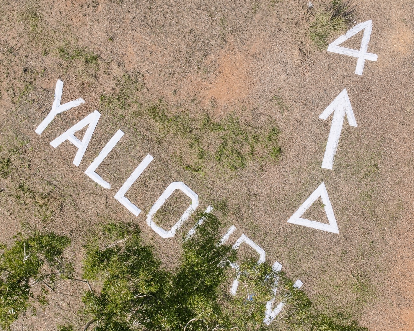
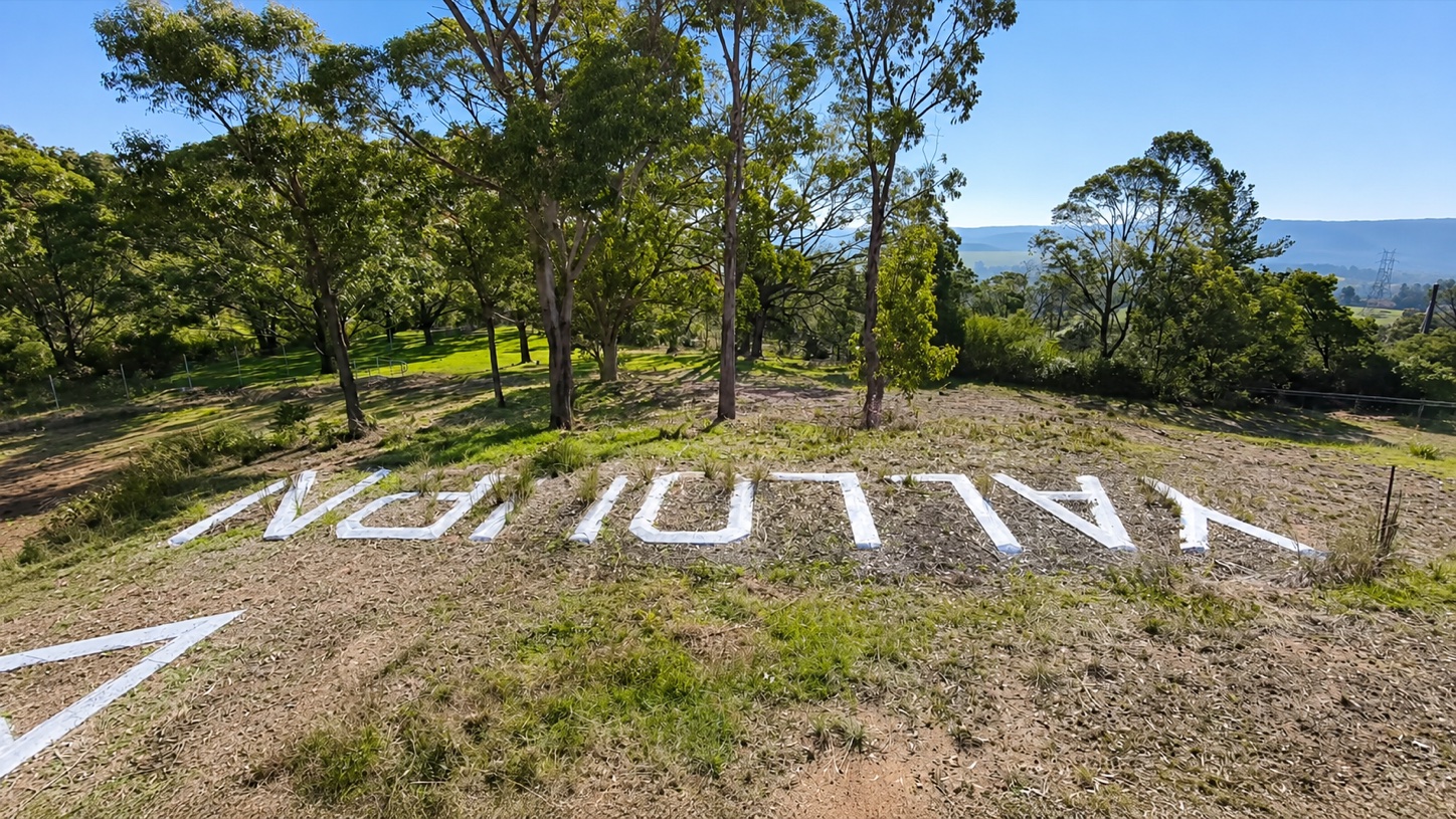
Aerial view of the Yallourn ground sign, including the word Yallourn, directional arrow, triangles and the number four.
Sir John Monash Museum

Protecting the evidence. Following the story.

The Foundation’s current research identifies the Yallourn Aerial Navigation Marker as the only known surviving ground-navigation installation created for a Sir Charles Kingsford Smith arrival. Its concrete letters, arrow and numeral remain in place, connecting Yallourn’s industrial landscape with Australia’s early aviation story.

Preserving the marker while research into its origins continues keeps the physical evidence available for investigation and allows its potential heritage significance to be properly considered through the mine-rehabilitation process.

Eden of the East Foundation’s current research links the marker’s construction and purpose to Sir Charles Kingsford Smith’s arrival in Morwell in the Southern Cross on 29 October 1932. Research is continuing to identify the commissioning authority, establish the exact construction date and locate contemporary documentation describing its original purpose.

The Foundation is now working to strengthen and test this finding through further archival investigation, while seeking independent heritage assessment and input from government, statutory heritage and local authorities. This work will build the evidence required for potential Victorian and National Heritage nominations and help ensure the marker is properly considered through the mine-rehabilitation process.

From protection to interpretation

  1. Current focus 01Secure

    Seek interim protection and establish a baseline survey and condition record.

  2. Next 02Prove

    Continue archival, field, landing-ground and comparative research.

  3. Planned 03Assess

    Prepare the evidence for local, Victorian and potential National Heritage assessment.

  4. Planned 04Conserve and interpret

    Plan in-situ conservation and future interpretation when conditions allow.
Click or tap “Why this journey matters” or any waypoint to learn more.

  1. Yallourn’s story begins in Yallourn North Open waypoint

    Yallourn1879

    Yallourn’s story begins in Yallourn North

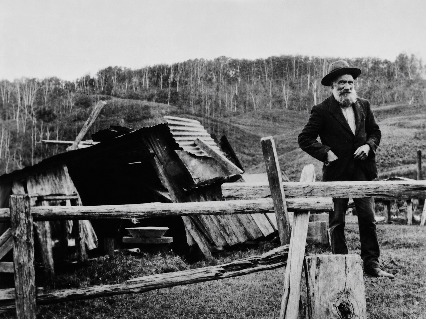
    Restored black-and-white photograph of Andy Anderson standing beside a timber and corrugated-iron hut on the Yallourn North hillside.
    Andy Anderson beside the hut believed to have been his home for approximately 40 years, photographed in 1924.Image: Yallourn North & District Historical Society. Restored by Sir John Monash Museum.

    Leg 01 · Yallourn foundations

    Yallourn North’s story began before there was a Yallourn and before the settlement had an official name. Brown coal was found near the Latrobe River in 1879, and mining gradually drew people to the hilltop community that became known as Brown Coal Mine.

    Swedish-born Andy Anderson is believed to have been the first European settler on the hill, arriving around 1884. He lived for approximately 40 years in a simple hut—a reminder that a community was taking shape before the wider Yallourn industrial landscape emerged.

    The planned town of Yallourn was constructed south of the river from the early 1920s. The older Brown Coal Mine community remained distinct and was renamed Yallourn North in 1947. Despite what its name suggests, Yallourn North was the earlier community.

  2. The Great Morwell mine opens at the future Yallourn North Open waypoint

    Yallourn1889–1899

    The Great Morwell mine opens at the future Yallourn North

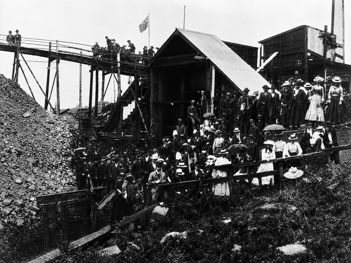
    Restored black-and-white photograph of a large gathering of men, women and children among timber mine buildings and elevated coal-handling structures at Yallourn North.
    Visitors gather among the timber buildings and coal-handling structures at the former Great Morwell Brown Coal Mine, now Yallourn North. The photograph is believed to record an open day or organised gathering, but its exact date and occasion have not yet been confirmed.Image: Victorian Department of Mines and Energy. Restored by Sir John Monash Museum.

    Leg 01 · Yallourn foundations

    The Great Morwell Coal Mining Company was formed in 1889 to turn the brown-coal deposit north of the Latrobe River into a commercial mine. Production began around 1890, supported by mine buildings, coal-handling equipment and a private railway connection.

    The operation became an important early testing ground for brown coal. Victoria’s first brown-coal briquettes were produced there in 1892, but technical difficulties, competition from imported black coal and a bushfire made the venture unsustainable. The mine had closed by 1899.

    The Great Morwell Coal Mining Company established the industrial site that the Victorian Government reopened in 1917, a precursor that helped establish the viability of the Yallourn power station project. The community that developed around it became Brown Coal Mine and, in 1947, Yallourn North.

  3. Before Yallourn, the old mine returns to work Open waypoint

    Yallourn1916–1917

    Before Yallourn, the old mine returns to work

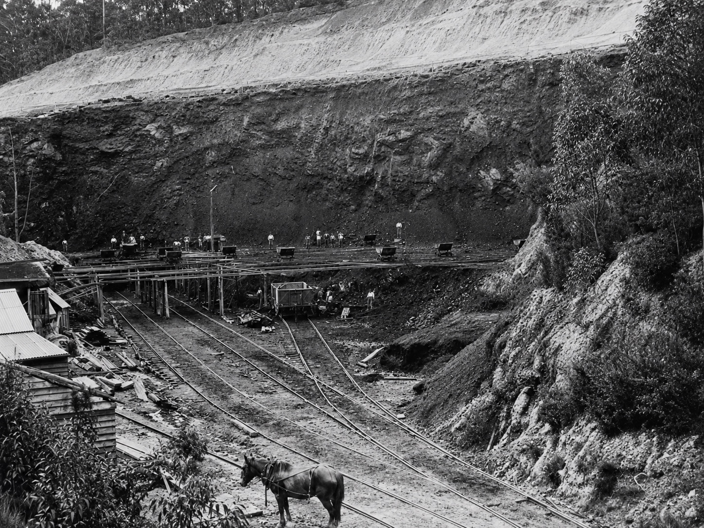
    Restored black-and-white photograph of workers, mine wagons, narrow-gauge tracks and a harnessed horse within the early Morwell Brown Coal Mine open cut.
    Workers, small wagons and horse haulage in the former Morwell Brown Coal Mine, now known as Brown Coal Mine and later Yallourn North Open Cut. These labour-intensive workings north of the Latrobe River preceded the new Yallourn open cut and power station developed on the southern side.Image: Geological Survey of Victoria / Resources Victoria. Restored by Sir John Monash Museum.

    Leg 01 · Yallourn foundations

    Before Yallourn existed, the Victorian Government returned to the abandoned Great Morwell mine north of the Latrobe River. Wartime fuel shortages and the New South Wales coal strike prompted the Mines Department to reopen the workings under the supervision of Hyman Herman.

    Workers, narrow-gauge tracks, small wagons and horse haulage brought the old workings back into production. This was not yet Yallourn; it was the earlier mine and settlement north of the river, demonstrating that the Latrobe Valley’s brown coal could be worked and supplied to Victorian industry.

    The emergency reopening helped turn attention towards a much larger state electricity scheme. In 1917, the Victorian Government appointed the Brown Coal Advisory Committee to investigate the commercial use of brown coal, particularly for large-scale electricity generation. The future Yallourn site had not yet become a construction site, but the project had begun to take form.

  4. Aerial mail reaches Moe and Morwell before Yallourn Open waypoint

    Aviation30 July 1920

    Aerial mail reaches Moe and Morwell before Yallourn

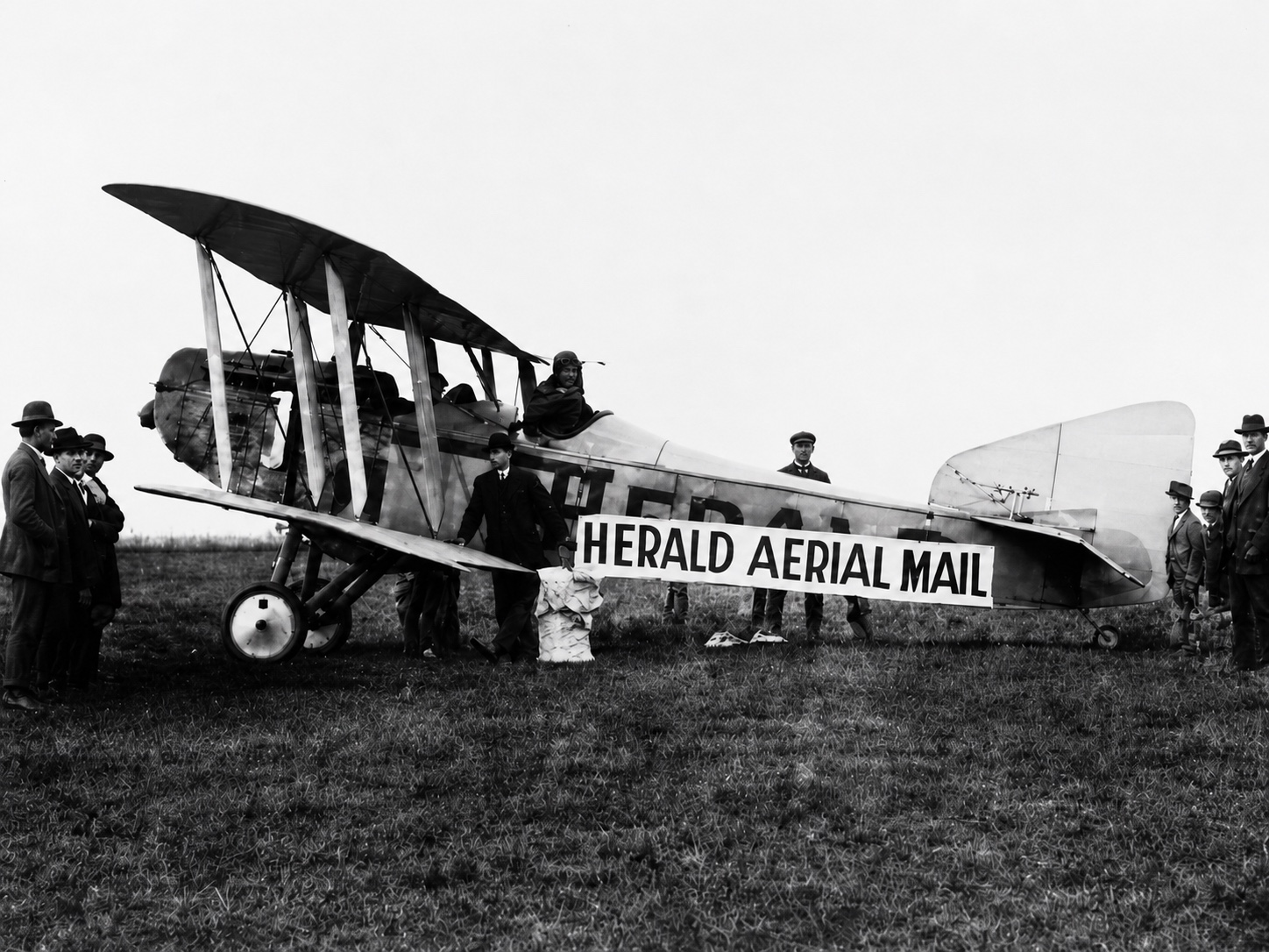
    Restored black-and-white photograph of a biplane carrying a Herald Aerial Mail banner, surrounded by people before its 1920 Gippsland delivery flight.
    The Herald and Weekly Times aircraft photographed shortly before departing West Melbourne to deliver letters and newspapers to Gippsland towns on 30 July 1920.Image: The Weekly Times. Restored by Sir John Monash Museum.

    Leg 02 · Place and flight

    Before Yallourn existed, aircraft were already beginning to connect the communities of Gippsland. On 30 July 1920, Captain W. E. Leggatt flew an experimental Herald and Weekly Times aerial-mail service from West Melbourne to Traralgon.

    The aircraft landed at Warragul and Trafalgar and dropped mail for Darnum, Yarragon, Moe and Morwell before reaching Traralgon. The flight demonstrated how aircraft could rapidly connect communities that had previously depended upon road and rail.

    At this point, there was still no established town or industrial landmark called Yallourn. The planned town, open cut, power station and reservoirs that would soon transform the landscape were yet to be built.

    The experiment did not establish an ongoing regional airline service. Regular scheduled passenger flights between Melbourne and Bairnsdale commenced almost thirty years later, on 27 March 1950, using an Australian National Airways Douglas DC-3.

  5. The SEC builds Yallourn to power Victoria Open waypoint

    Yallourn1918–June 1924

    The SEC builds Yallourn to power Victoria

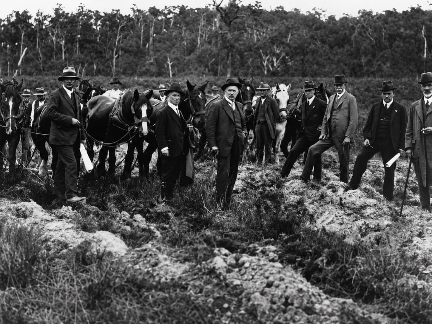
    Restored black-and-white photograph of State Electricity Commission commissioners and senior staff with horses at the turning of the first sod for Yallourn A Power Station in February 1921.
    State Electricity Commission commissioners and senior staff gather for the turning of the first sod for Yallourn ‘A’ Power Station on 5 February 1921. Sir John Monash stands among the group holding rolled plans.Image: Museums Victoria, Item MM 9578. Restored by Sir John Monash Museum.

    Leg 02 · Place and flight

    The Electricity Commissioners Act was passed in 1918, establishing the framework for a coordinated Victorian electricity system. The Electricity Commissioners were constituted in 1919 and began planning how the Latrobe Valley’s brown coal could be used to generate electricity on a scale large enough to serve the state.

    Sir John Monash was appointed General Manager on 1 October 1920 and subsequently Chairman. On 10 January 1921, the Electricity Commissioners became the State Electricity Commission of Victoria. Less than a month later, on 5 February, the first sod was turned for Yallourn ‘A’ Power Station, marking the transition from investigation and planning to construction.

    Over the next three years, workers created an interconnected industrial landscape: the Yallourn open cut, power station, water-supply works, rail connections, workshops, transmission infrastructure and a planned township for the workforce. By June 1924, the first generating plant and its connection to Melbourne were ready. The next waypoint records the moment Yallourn power entered the metropolitan system.

  6. Yallourn power transforms Victoria Open waypoint

    Yallourn1924–1932

    Yallourn power transforms Victoria

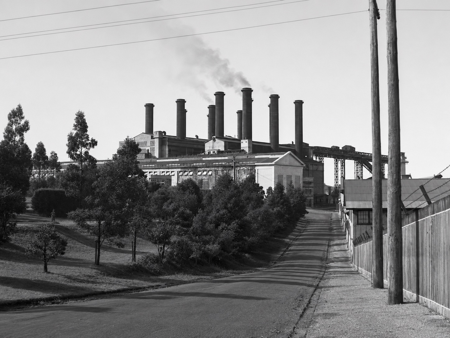
    Restored black-and-white view along a road towards Yallourn Power Station, with gardens, industrial buildings, power lines and multiple tall chimneys.
    Yallourn Power Station became the generating centre of Victoria’s expanding state electricity system. Its power supported homes, public services and industry across a growing network.Original image source unverified. Restored by Sir John Monash Museum.

    Leg 02 · Place and flight

    On 15 June 1924, electricity generated from Yallourn brown coal reached Melbourne. The new power station placed generation beside an abundant fuel supply, reducing Victoria’s dependence on transported black coal and providing the basis for an interconnected state electricity system.

    The benefits reached well beyond the power station. By 1932, the State Electricity Commission reported that the average cost of domestic electricity had fallen by approximately 40 per cent in metropolitan Melbourne and 38 per cent in country districts since Yallourn began operating. Earlier tariff reductions had delivered an estimated £750,000 in benefits to consumers.

    The Commission recorded a loss in 1925–26, followed by a modest net profit in 1927–28. By 1931–32, its operations produced a profit of £206,569 before exchange costs and other statutory deductions. The operating result demonstrated the economic strength the system had developed.

    Reliable, increasingly affordable electricity supported homes, public services, transport and industry. Yallourn helped lay the foundations for Victoria’s emergence as an industrial powerhouse and became a prominent expression of the state’s confidence in public infrastructure.

    By 1932, Yallourn had developed a highly technical workforce, administrative capacity and civic ambition. The Yallourn Aerial Navigation Marker stands on land then controlled by the Commission, which possessed the skills and resources required to construct such an installation. These circumstances make the Commission’s possible involvement an important focus of the Foundation’s continuing research.

  7. Kingsford Smith flies the Southern Cross to Morwell Open waypoint

    Aviation29 October 1932 · 11:15 am

    Kingsford Smith flies the Southern Cross to Morwell

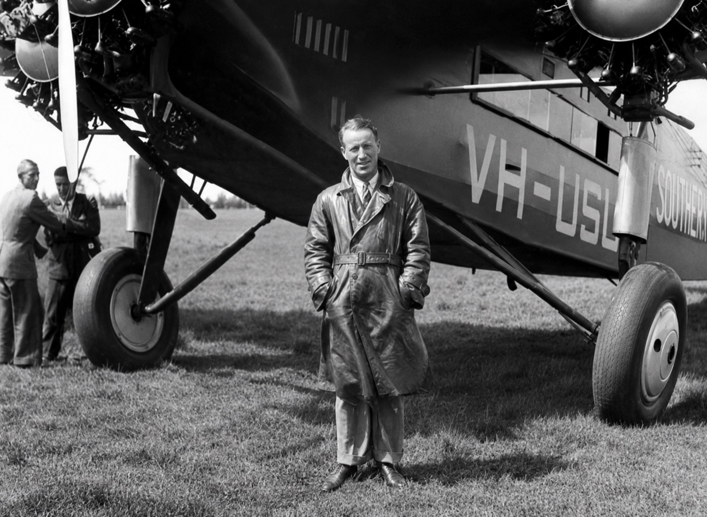
    Restored black-and-white photograph of Sir Charles Kingsford Smith standing beside the Southern Cross aircraft at Morwell in 1932.
    Sir Charles Kingsford Smith stands beside the Southern Cross at Morwell during his 1932 Gippsland visit, when the aircraft offered joy flights.Image: Morwell & District Historical Society. Restored by Sir John Monash Museum.

    Leg 02 · Place and flight

    At 11:15 am on 29 October 1932, Sir Charles Kingsford Smith arrived in Morwell in the Southern Cross. A temporary landing ground had been prepared on the Budge property south of Wallace Street, where Des Kelly maintained a smoke fire to show the direction of the wind.

    By 1932, Yallourn’s open cut, power station and reservoirs formed a distinctive landmark visible from the air. Eden of the East Foundation’s research interprets the surviving marker as a complete instruction for the approaching aircraft: YALLOURN identified its position, the arrow supplied the bearing towards Morwell and the numeral 4 indicated the approximate distance to the prepared field.

    No continuing aviation use of the Budge landing ground has yet been identified after the visit. This makes the arrival central to the marker’s story: the event supplied the destination that allows the word, arrow and numeral to function as one coherent navigational instruction.

    The Foundation is continuing its archival investigation and seeking independent heritage assessment to test and strengthen this interpretation, including identifying who commissioned the marker and precisely when it was constructed.

  8. Brown Coal Mine becomes Yallourn North Open waypoint

    Yallourn1 August 1947

    Brown Coal Mine becomes Yallourn North

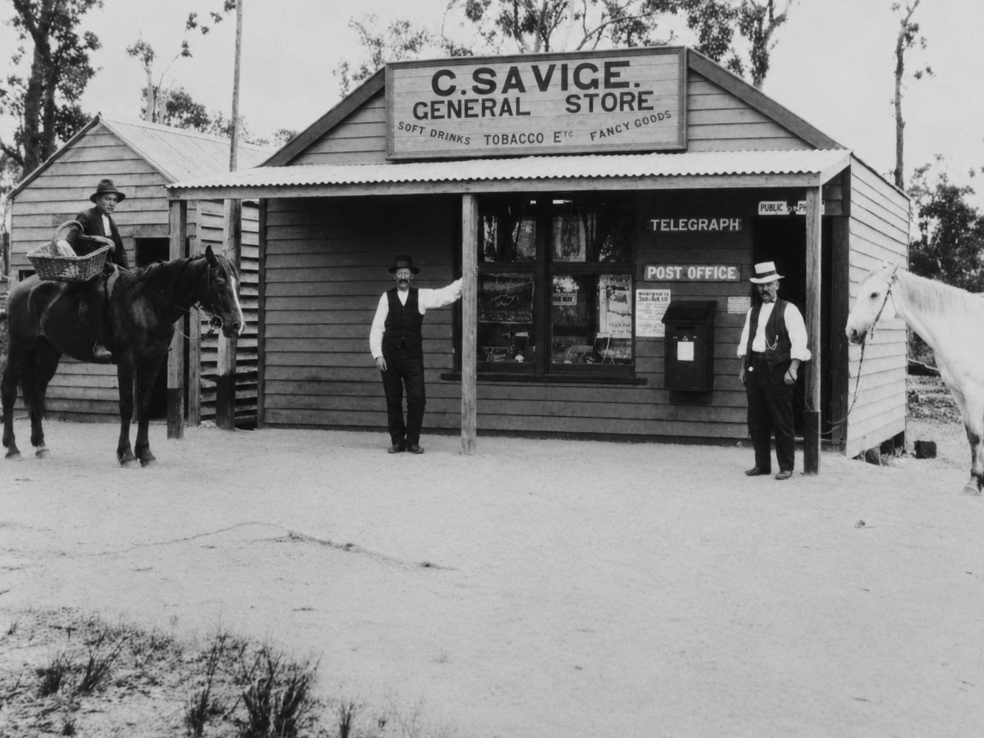
    Restored black-and-white photograph of Charlie Savige’s general store, post office and telegraph office at Brown Coal Mine in 1917, with three men and two horses outside.
    Charlie Savige’s General Store, Post Office and Telegraph Office at Brown Coal Mine in 1917. The post office was registered under the name Brown Coal Mine on 3 September 1917—thirty years before the settlement became Yallourn North.Image shared through Gippsland History. Original holding collection to be confirmed. Restored by Sir John Monash Museum.

    Leg 02 · Place and flight

    From 1 August 1947, the settlement long known as Brown Coal Mine was officially called Yallourn North. The new name placed the older hilltop community in relation to the planned town of Yallourn across the Latrobe River. A contemporary report described it as approximately two miles north of Yallourn.

    The renaming recognised a community that had survived despite expectations that it would disappear as Yallourn developed. Brown Coal Mine had grown independently, providing more affordable housing for workers and developing its own shops, services and strong community identity. In the postwar years, new housing and an expanding workforce transformed it into a larger permanent town.

    The change also clarifies the aerial marker’s chronology. When Sir Charles Kingsford Smith arrived in 1932, the concrete word YALLOURN referred to the established industrial complex and planned town south of the river. The northern settlement was still called Brown Coal Mine and would not become Yallourn North for another fifteen years.

  9. The mine closes, but Yallourn North endures Open waypoint

    YallournMay 1963

    The mine closes, but Yallourn North endures

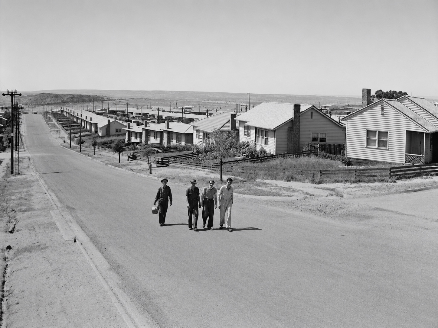
    Restored black-and-white photograph of four workers walking up North Road in Yallourn North, with postwar houses lining the hillside behind them.
    Workers walk home up North Road in Yallourn North. The scene reflects the close relationship between the town and the workforce whose daily lives sustained the Latrobe Valley’s brown-coal industry.Image: Ilawarra Northern District Historical Society. Restored by Sir John Monash Museum.

    Leg 02 · Place and flight

    The original Yallourn North Open Cut ceased mining in May 1963. Developed from the nineteenth-century Great Morwell workings, it had become an important source of emergency and supplementary brown coal under the State Electricity Commission.

    During the wartime and postwar years, its coal supported Newport Power Station and supplied factories, hospitals and other essential users when black coal and briquettes were in short supply. Mining progressively transferred to the Yallourn North Extension, which had begun producing coal in 1956.

    The mine’s closure did not bring the town’s story to an end. New housing, services and postwar migration had transformed Yallourn North into a permanent community whose identity extended beyond the open cut. The town remained while the wider Yallourn industrial landscape continued to change around it.

    Through those changes, the Yallourn Aerial Navigation Marker remained in the industrial landscape—preserving a physical connection between the region’s development, its workforce and the aviation story plotted through this course.

  10. The decision is made to remove Yallourn Open waypoint

    Yallourn1969–1970

    The decision is made to remove Yallourn

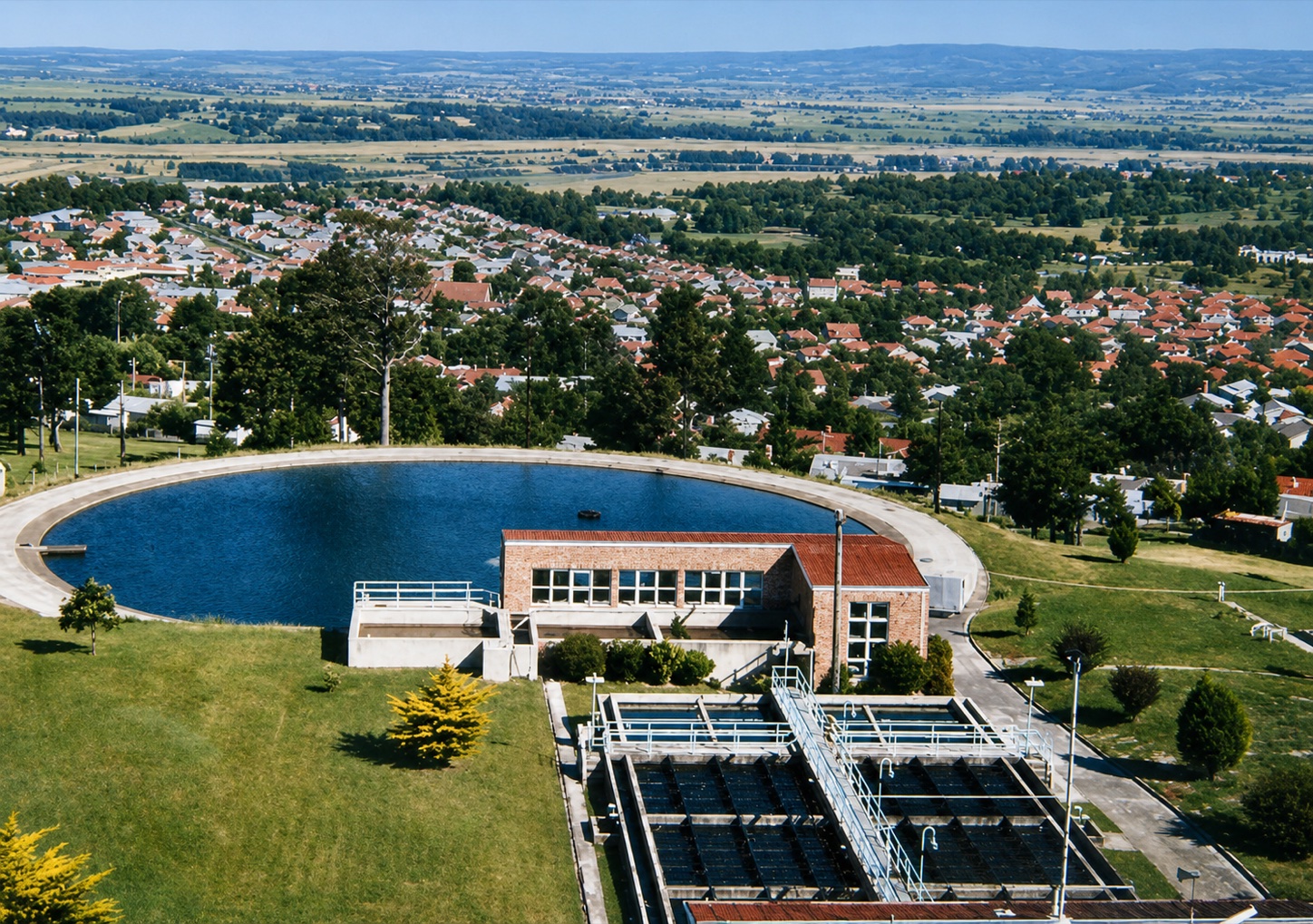
    View from the Yallourn reservoir across the treatment works towards the houses, trees and streets of Yallourn before the town was removed.
    Yallourn viewed from the reservoir before the town was removed.Image: Virtual Yallourn. Restored by Sir John Monash Museum.

    Leg 02 · Place and flight

    In 1969–70, the State Electricity Commission declared that Yallourn would be removed as the surrounding mine and generating system entered another phase of expansion. The organisation that had created the model town now determined that its site would be surrendered to open-cut mining.

    The decision placed the homes, schools, theatre, churches, sporting facilities and public spaces built over almost fifty years on a staged path to closure. Residents would be relocated across the Latrobe Valley, particularly to Moe, Newborough, Morwell, Traralgon and Yallourn North.

    The Save Yallourn Committee and its supporters campaigned to retain the town and its community facilities. Although the campaign did not reverse the decision, it recorded the strength of local resistance and the social cost of dismantling a place built around public electricity generation.

    This was a turning point in the marker’s story. YALLOURN remained visible in concrete on the ground, but the future of the town identified by that name had been decided.

  11. The town disappears, but YALLOURN remains Open waypoint

    YallournBy 1983

    The town disappears, but YALLOURN remains

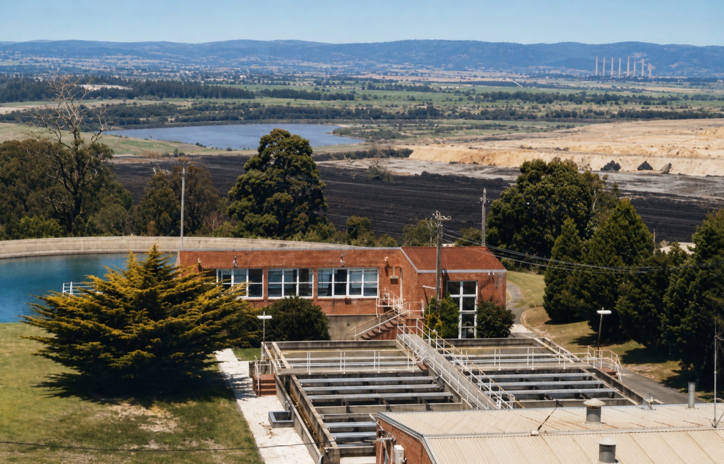
    View from the Yallourn reservoir across the treatment works towards the cleared former town site and open-cut mine after Yallourn was removed.
    The former Yallourn town site viewed from the reservoir after the town was removed.Image: Virtual Yallourn. Restored by Sir John Monash Museum.

    Leg 02 · Place and flight

    Throughout the 1970s and into the early 1980s, Yallourn was dismantled section by section. Houses were removed, civic buildings closed or demolished and residents dispersed across nearby towns. By the early 1980s, the physical township had been removed.

    Many Yallourn houses survived by being relocated, while clubs, memorials, services and community relationships continued elsewhere. The town disappeared as a physical place, but its people and institutions remained part of the Latrobe Valley.

    The marker therefore carries an unusual significance: its concrete word YALLOURN survived in the industrial landscape after the town it named had disappeared. Preserving it protects a physical connection to a place now carried largely through archives, relocated buildings and community memory.

  12. The Foundation contacts EnergyAustralia Open waypoint

    Project action17 July 2026

    The Foundation contacts EnergyAustralia

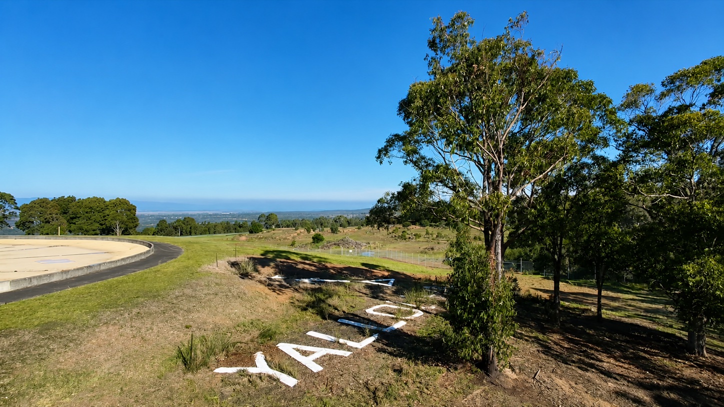
    The Yallourn Aerial Navigation Marker in 2026, with its concrete letters and numeral 4 visible on the hillside beside trees.
    The Yallourn Aerial Navigation Marker as it appears in 2026.Image supplied by Eden of the East Foundation, 2026.

    Leg 03 · Preservation

    Eden of the East Foundation raised preservation of the marker with EnergyAustralia, the operator and rehabilitation-area custodian.

    • The immediate project priority remains a defined no-disturbance response, baseline survey and condition record while assessment proceeds.
    Actor
    Eden of the East Foundation Inc.
    Action
    Contacted EnergyAustralia regarding awareness, preservation and consideration of the marker in rehabilitation planning.
    Recorded outcome
    EnergyAustralia confirmed awareness of the marker and that it would ensure the marker was considered in rehabilitation planning.

    StatusThis acknowledgement is not a protection decision, statutory recognition or endorsement.

  13. Foundation research report completed Open waypoint

    Project action29 July 2026

    Foundation research report completed

    The concrete YALLOURN letters of the aerial navigation marker seen across the hillside among trees in 2026.
    The Yallourn Aerial Navigation Marker as it appears in 2026.Image supplied by Eden of the East Foundation, 2026.

    Leg 03 · Preservation

    The Eden of the East Foundation’s Version 1.1 research report brings the physical evidence, historical chronology, competing explanations, heritage potential and next research priorities into one working foundation.

    • The report explicitly records limitations and evidence still required, including commissioning documentation, professional survey and national comparative research.

    Yallourn Aerial Navigation Marker — Heritage Research Foundation

    • The word, arrow and numeral form a coherent aerial instruction: position, bearing and approximate distance.
    • Yallourn had become a conspicuous industrial landmark by 1932.
    • The arrow points towards the Morwell landing-ground corridor and the numeral corresponds with the approximate distance to the Budge property area.
    • The wartime-warning, regular-airway and White City explanations do not account for the complete design as well as the 1932 arrival hypothesis.
    • Protection, survey, archival research, comparative study and reconstruction of the Budge landing ground remain priorities.
    Open complete report PDF · 2.4 MB
    Actor
    Eden of the East Foundation Inc. with the Sir John Monash Museum
    Action
    Prepared the Yallourn Aerial Navigation Marker Heritage Research Foundation.
    Recorded outcome
    A documented working case is available for protection discussions, further investigation and potential heritage assessment.

    StatusThe report is a research foundation, not a statutory heritage determination.

  14. Twenty-one principal correspondence items sent Open waypoint

    Project action30 July 2026

    Twenty-one principal correspondence items sent

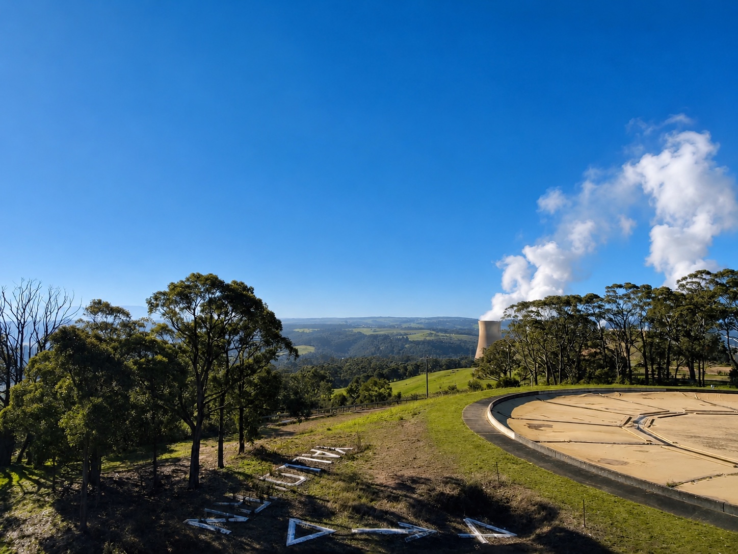
    Wide 2026 view of the Yallourn Aerial Navigation Marker beside the reservoir, with power-station infrastructure visible in the distance.
    The Yallourn Aerial Navigation Marker as it appears in 2026.Image supplied by Eden of the East Foundation, 2026.

    Leg 03 · Preservation

    The Foundation circulated the covering letter and research report across government, heritage, community, engineering, academic, aviation, archival and cultural organisations.

    • Government, regulatory and statutory heritage bodies — 5 principal items.
    • Local government and regional community organisations — 6 principal items.
    • Statewide historical, engineering and academic organisations — 4 principal items.
    • Aviation, archival and national cultural organisations — 6 principal items.
    Actor
    Eden of the East Foundation Inc.
    Action
    Sent 21 principal items of correspondence seeking protection, evidence, expertise and consideration through heritage and mine-rehabilitation processes.
    Recorded outcome
    The relevant organisations have been asked to assist; responses and offers of support will be recorded here as they are received and verified.

    StatusSending correspondence does not indicate that a recipient supports the project.

This is an interpretive historical course, not an aeronautical or geographic chart.